
My Trip To Myanmar – A day in Mandalay by Richard Do
After 2 days in Yangon, we took express bus to Mandalay. It is about $12 USD for an Air-Con bus and $10 for non Air-Con, scheduled around 10 hours but will take closer to 12.
Hot, busy and not immediately beautiful, Mandalay is primarily used by travellers as a transport and day-trip hub. But even amid the central grid of lacklustre concrete block ordinariness lurk many pagodas, striking churches, Indian temples and notable mosques. West of centre towards the fascinating Ayeyarwady (Irrawaddy) riverside, shadier backstreets link countless little-visited monasteries. And there’s plenty of fascination to be found delving into a range of craft workshops and arts performances.
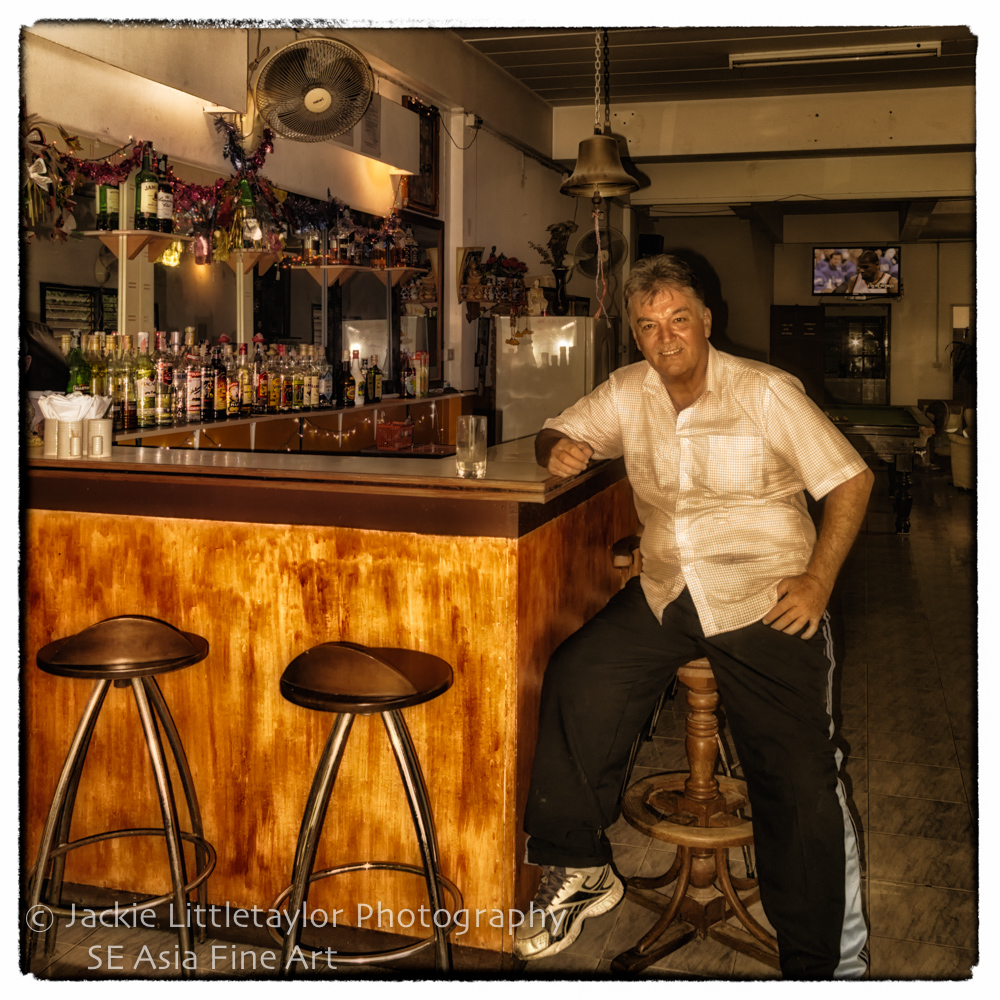
 Photo By Richard DO
 Photo By Richard DO
 Photo By Richard DO
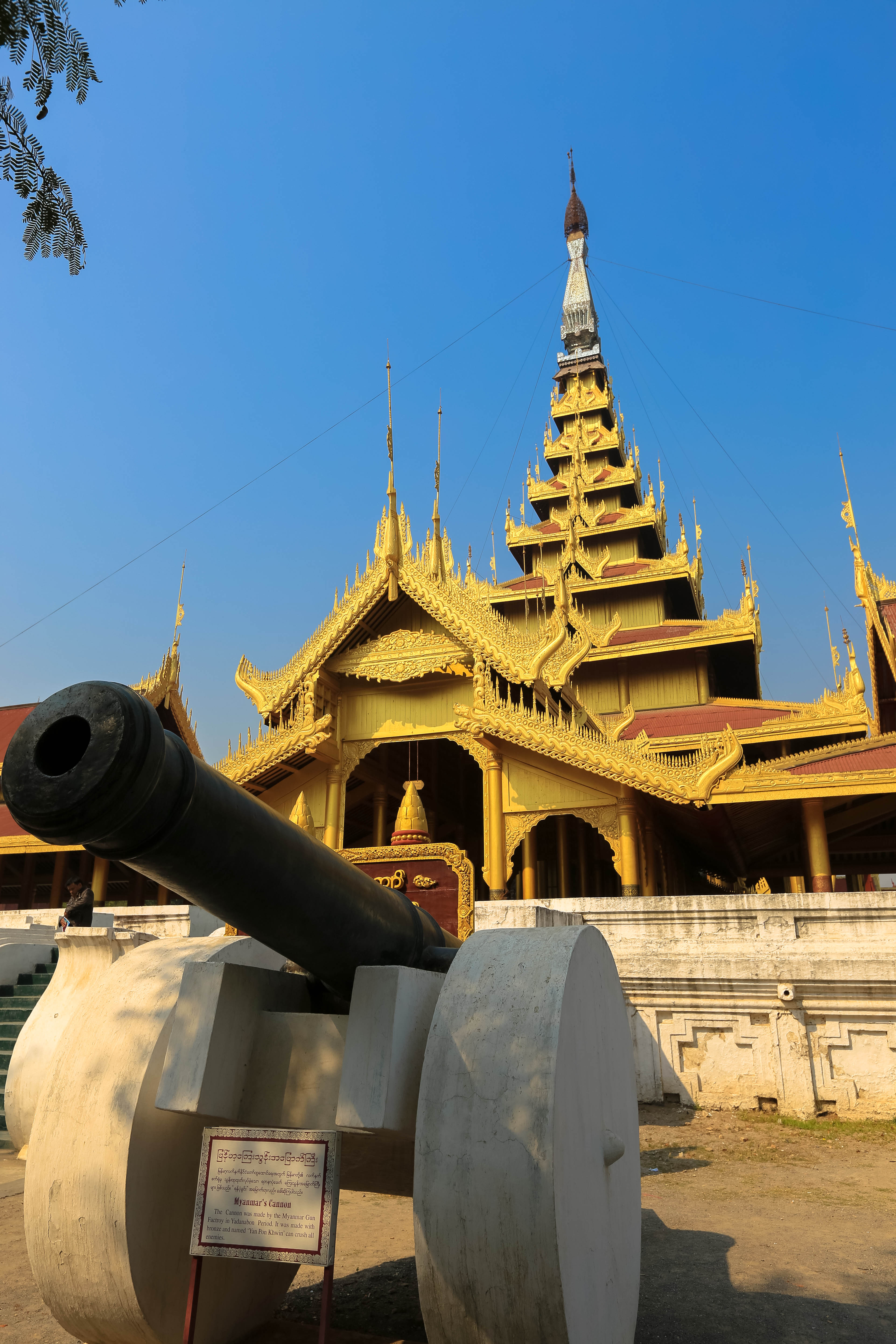
Like most former (and present) capitals of Burma, Mandalay was founded on the wishes of the ruler of the day. On 13 February 1857, King Mindon founded a new royal capital at the foot of Mandalay Hill, ostensibly to fulfill a prophecy on the founding of a metropolis of Buddhism in that exact place on the occasion of the 2,400th jubilee of Buddhism.
King Mindon is the founder of Mandalay royal capital
A bastion at Mandalay Palace
The new capital city site was 66 km2 (25.5 sq mi) in area, surrounded by four rivers. The plan called for a 144-square block grid patterned citadel, anchored by a 16 square block royal palace compound at the center by Mandalay Hill. The 1020-acre (413-hectare) citadel was surrounded by four 2,032 m (6,666 ft) long walls and a moat 64 m (210 ft) wide, 4.6 m (15 ft) deep. At intervals of 169 m (555 ft) along the wall, were turrets with gold-tipped spires for watchmen.The walls had three gates on each side, and five bridges to cross the moat. In addition, the king also commissioned the Kuthodaw Pagoda, the Pahtan-haw Shwe Thein higher ordination hall, the Thudhamma Zayats or public houses for preaching the Doctrine, and the library for the Buddhist scriptures. In June 1857, the former royal palace of Amarapura was dismantled and moved by elephants to the new location at the foot of Mandalay Hill although construction of the palace compound was officially completed only two years later, on Monday, 23 May 1859.
For the next 26 years, Mandalay was to be the last royal capital of the last independent Burmese kingdom before its final annexation by the British. Mandalay ceased to be the capital on 28 November 1885 when the conquering British sent King Thibaw and his queen Supayalat into exile, ending the Third Anglo-Burmese War.
 Photo By Richard DO
 Photo By Richard DO
 Photo By Richard DO
Mandalay is ethnically diverse, with the Bamar (Burmans) forming a slight majority. In recent years, there has been a major influx of Chinese from Mainland China, and the local Chinese (both recent migrants and descendants of colonial-era immigrants) form 30 to 40% of the population. Their influence is seen in the China-style glass buildings throughout the city, while the Yunnan dialect of Mandarin is often spoken among the ethnic Chinese community. Other prevalent ethnic groups include the Shan, who are ethnically and linguistically related to the Thais and Laotians, and the Karen (Kayin). There is a sizeable ethnic Indian population, including Nepalis and Sikhs.
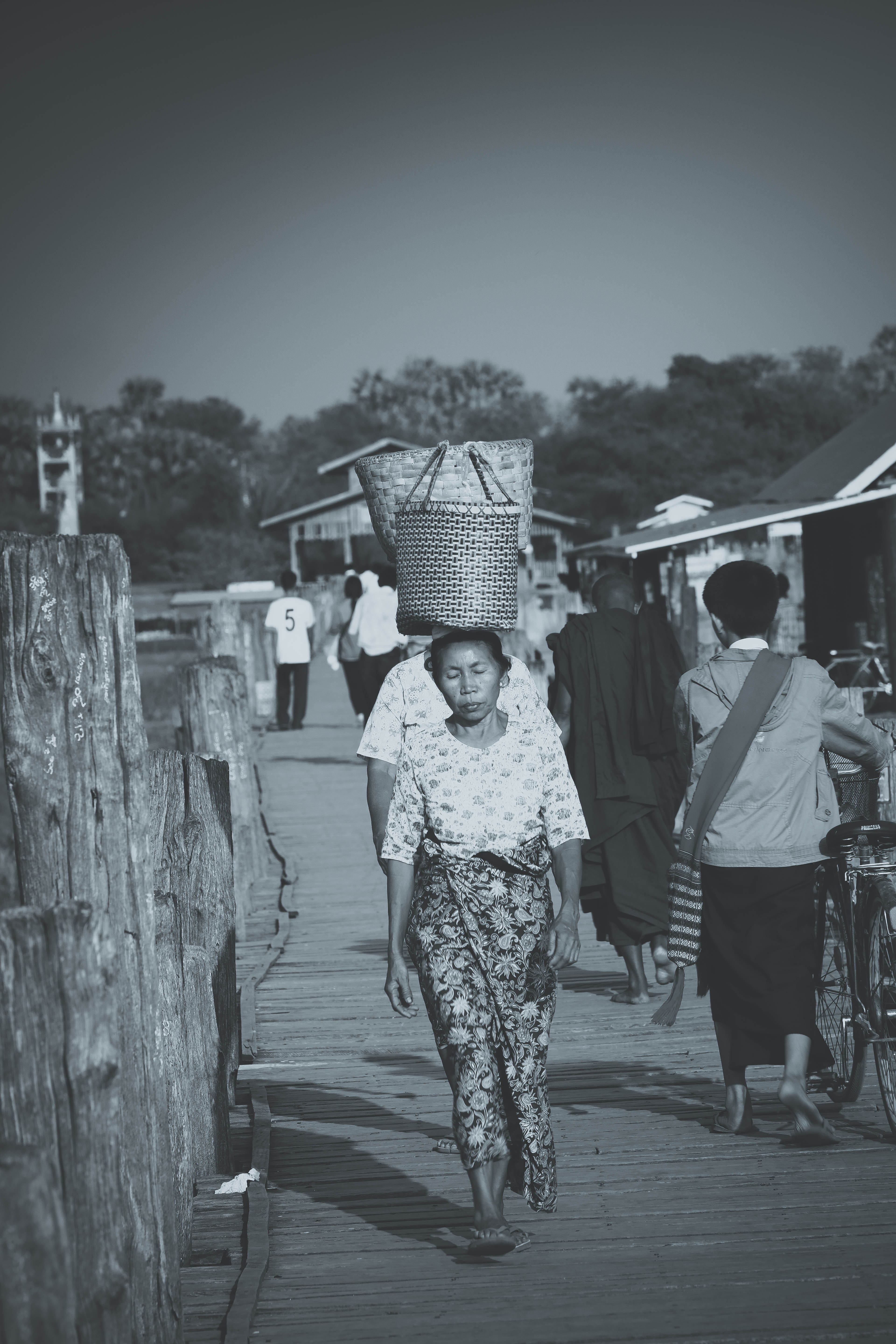 Photo By Richard DO
 Photo By Richard DO
U Bein Bridge is a crossing that spans the Taungthaman Lake near Amarapura in Myanmar. The 1.2-kilometre (0.75 mi) bridge was built around 1850 and is believed to be the oldest and longest teakwood bridge in the world. Construction began when the capital of Ava Kingdom moved to Amarapura, and the bridge is named after the mayor who had it built. It is used as an important passageway for the local people and has also become a tourist attraction and therefore a significant source of income for souvenir sellers. It is particularly busy during July and August when the lake is at its highest.
The bridge was built from wood reclaimed from the former royal palace in Inwa. It features 1,086 pillars that stretch out of the water, some of which have been replaced with concrete. Though the bridge largely remains intact, there are fears that an increasing number of the pillars are becoming dangerously decayed. Some have become entirely detached from their bases and only remain in place because of the lateral bars holding them together. Damage to these supports have been caused by flooding as well as a fish breeding program introduced into the lake which has caused the water to become stagnant. The Ministry of Culture’s Department of Archaeology, National Museum and Library plans to carry out repairs when plans for the work are finalised.
From 1 April 2013, eight police force personnel have been deployed to guard the bridge. Their presence is aimed at reducing anti-social behaviour and preventing criminal activities, with the first arrest coming in September 2013 when two men were reported for harassing tourists. Photo By Richard DO
 Photo By Richard DO
The bridge was built in curve shape in the middle to resist the assault of wind and water. The main teak posts were hammered into lake bed seven feet deep. The other ends of the posts were shaped conically to make sure that rain water fall down easily. The joints were intertwined.
Originally, there were 984 teak posts supporting the bridge and two approach brick bridges. Later the two approach brick bridges were replaced by wooden approach bridge. There are four wooden pavilions at the same interval along the bridge. By adding posts of two approach bridges and four pavilions, the number of posts amounts to 1089.
There are nine passageways in the bridge, where the floors can be lifted to let pass the big boats and barges. There are altogether 482 spans and the total length of the bridge measures 3967 feet of ¾ of a mile.
 Photo By Richard DO
 Photo By Richard DO
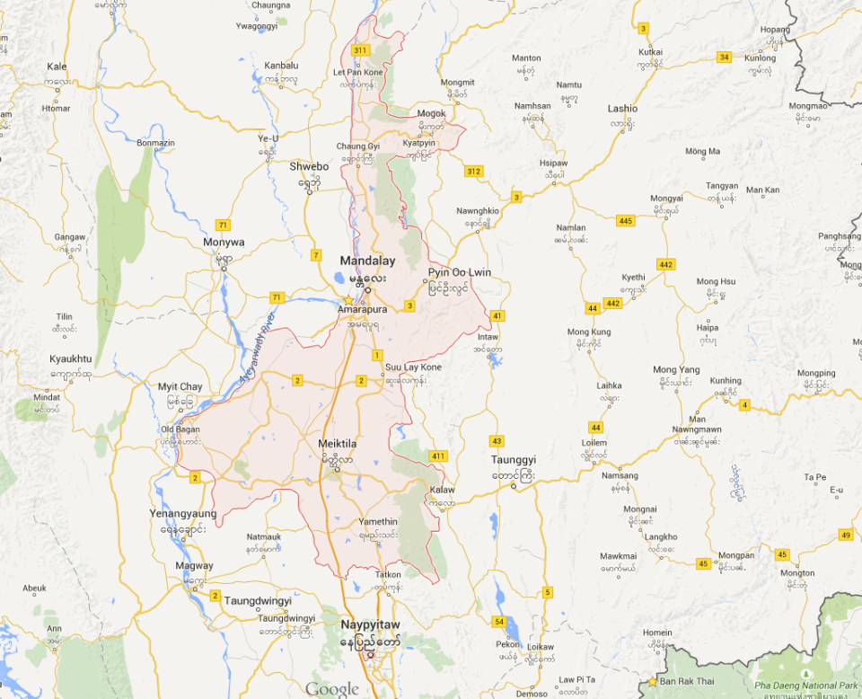
Maps Mandalay Region click for larger map
Map of Mandalay Hill click here for larger map


